Monday, October 5, 2009

A Trip to Gopalaswamy betta and BR hills

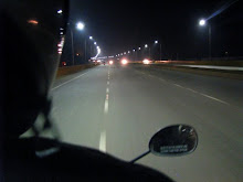
We went to Gopalaswamy betta and B R Hills last weekend i.e., on October 2nd 2009. The main intention of the trip was a bike riding. We left Bangalore on Friday early morning at around 5:15 am and reached our first pit-stop for tea in Mysore at 7:45 am.
We left Mysore at around 8:00 am and started moving towards to Gundlupet for breakfast. There are quite a few scenic places on the way along the long road stretches with trees on either side with good road condition. I was really missing a good Digital-Cam on the tour, but had to be satisfied with our Sony mobile cameras. We finally stopped for breakfast on the way to Gopalaswamy betta at around 9:30 am in Gundlupet (UDUPI UPAHAR: Breakfast was quite good).
From Gundlupet to Gopalaswamy hill it’s a mere 18 odd kms but travelling through the rough roads are quite bad. The stretch from Gundlupet to Hangala is very bad as asphalting is in progress. Gopalaswamy hill range seemed endless. If you check this place in Google maps, you will realize that this is a huge range covered with a lot of greenery. We reached the temple (Lord Krishna) by 11:45 through the dense fog which was all over the Himavad Gopalaswamy Betta and the visibility was mere 50 mtrs.
After some photography sessions we then left to B R Hills. We had miscalculated the distance to be 100 odd km from Gopalaswamy betta. But the distance turned out to be 76km! From Gundlupet to B R Hills.we reached Gundlupet and took a right turn which leads to Chamarajanagar which is around 26 kms then stopped for lunch @ SRI KAMAKSHI ULTRA DARSHINI, Chamarajanagar(Quite a good Hotel and quality is also food )
From Chamarajanagar one can go to B R Hills in two different ways :
1. Go to Santemarahalli Junction -> Yelandur -> B. R. Hills. Distance : 40 Odd kms
2. Go to K Gudi -> B. R. Hills. Distance : 45 Odd kms
However we planned to go around the BR Hills so we took K Gudi way, the road trip to B. R. Hills was quite amazing. As you enter the forest, you can see a sudden drop in temperature and silence. You can also hear a lot of birds/insects chirping giving you a feel of the forest. The sad part was we weren’t lucky enough to have a glimpse of anything (atleast an elephant) throughout our journey. Finally we reached Temple at 4:30 pm as per our plan and visited the temple of Ranganatha (Lord Vishnu). Then, we got to experience the sunset on B. R. Hills. There is a spot in one corner where you can see a steep drop and the stretch of the hills, covered with a lot of trees. This is something that you need to experience and is hard to describe in words.
We started back to Mysore at around 5:30 pm in the evening. We took B. R. Hills -> Yelandur -> Santemarahalli road. At Santemarahalli junction there are two ways, which leads back to mysore. One - you can take a road(tuff route) through Nanjangud or travel through to Chamarajanagar and reach Mysore. Difference would be some 10 kms. Road conditions are bad at the moment to Mysore, but no one complained after the experience. We finally managed to reach Mysore at 9 pm.
The next morning we had some problem in one of the bikes (silencer problem). After going through from one end of mysore to other end we managed to find a shop which helped us get through the problem. Then we started towards Chamundi Hills and back to our room. We packed our bags had our lunch on the way to KRS. Took some snaps and our next stop was Balmuri falls. No one was really happy to get into water so took some rest sitting there and came back to Bangalore by Saturday evening 6:30 pm. Overall it was an amazing experience, and the final odo reading showed 700 kms to & fro.

Thanks for reading!!!!

Sunday, September 20, 2009

Tour de Upper Bhavani

Upper Bhavani : Picturesque beauty of "Queen of Nilgiris"

I, My Brother and 2 of my friends had planned to go to Upper Bhavani and this time we went on as planned (unlike previous plans we made)

While going we took the Bangalore-Kanakapura-Kollegal-Chamarajanagar-Sathyamangalam-Mettupalayam-Coonoor-Manjoor route and while coming back we took the Manjoor-Ooty-Bandipur-Gundlupet-Mysore-Bangalore route.
Bangalore to Coonoor roads is amazing for any bike rider. It’s quite an experience. There are a speed breakers here and there as well as small potholes which kills the joy of driving on this road. Add to this, some mud humps created by villagers without any warnings. Be careful. All-in-all Quite Good!

We stopped for our first photo shoot out at the greenery surrounded Mallavali at around 8 am which was just 115 km drive and then started towards Chamarajanagar for breakfast. Reached Chamarajanagar at 9:30 am and started searching for a Hotel to have food and finally got one (Sri Kamakshi Hotel) with affordable price and quality food. We freshened up quickly and settled down for heavy food.

We started our journey from Chamarajnagar towards Coonoor planning to through Kotagiri, but we went in the other direction forcing us to take Sathyamangalam and Dimbam Ghats enrouting through Bhavanisagar reservoir and then to Mettupalayam. Scorching sun and Hot-air was beating us, which made us to remember good-old Bangalore weather;
one has to be ready for these kind-off surprises! Finally after many Hair-pin bends and narrow roads reached the start point of "Queen of Nilgiris" in Mettupalayam at around 2 pm. Since sun was beating on us we had to take-off to have coconut water to beat the heat. We decided to look for accommodation and lunch in Coonoor, since in Ooty the cost to stay is way beyond our reach. We moved on with picturesque locations of Nilgiris halting our ride for every 5-10kms to have a photo session. Finally we reached Coonoor at 3:30 pm.

Accomodation: Venkys opposite to Coonoor railway station
Cost: Double bed room @ 300/day
Food: Sree ramachandra hotel @ Affordable price

At 5 pm, after much needed break we started our bikes to visit few of the many places around Coonoor. There are a lot of tourist attractions in Coonoor some classical viewpoints notably Dolphin's Nose, Lamb's Rock and Lady Canning's Seat and Katary. The roads leading to these places are in a very good shape and the views on this road are quite amazing. Photographers dream!!! We took a ride to Dolphin's Nose Viewpoint which is 10-12 km from Coonoor and is a spectacular spot to visit.It not only provides a panoramic view of the vast expanse of the Nilgiris Hills also the view of the famous Catherine Falls as well as tribal huts. By the time we reach the point it was around 5:45 pm, we were the last visitor of the day. Sun sets quite early at this part so we started towards Lamb’s rock view point which is on the way back to Coonoor from Dolphin's Nose, about 7 km from Dolphin's Nose to Lamb's Rock, another vantage point to view the fantastic landscape and the tea and coffee plantations.

Upper Bhavani is the highest reservoir in the whole project at 7470 feet above MSL with a capacity of 3022 mcft. I should say this is one of my most memorable trips; the place is so serene and breathtaking. The weather on that day was particularly good with small drizzle and mist cover throughout. Roads from Coonoor till Manjoor was awesome, after that expect a very bumpy ride for about 15-20 kms inside a thick forest area. Going in a small vehicle is advisable. You can pack your lunch at Manjoor as there are no hotels or shops after that. Basically it’s a "No man’s land".

FYI: I have heard that temperatures here plummet to subzero in winter forming ice sheets over water surfaces. Kora Kunda is the coldest place in this region where -4 degrees is usual for long periods of time. Such a rainfall is regularly being received only because the ecology is very much guarded in these places. Over the past 17 years, though much degradation of nature has taken place in all other areas of Nilgiris, the natural sholas and forests beyond Upper Bhavani have been preserved without a bit of damage, maintaining the ecosystem intact. The various flora and fauna are still flourishing thanks to the actions of forest and EB officials; however, it remains to be seen how long this can be sustained. Many a scientist from a number of countries still visits the Mukurthi Sanctuary for various biological projects including obtaining the purest water samples available on earth. Though, Mukurthi sanctuary in Upper Bhavani area is serene and beautiful and litter-free.

Upper Bhavani is about 10 kms from Korakundah and about 60 odd kms from Coonoor. We took Manjoor, Thaishola and the Korakundah tea estates way. These areas are rich and undisturbed wildlife habitat. The drive is most scenic passing dense jungles of shola, wattle, pine and eucalyptus interspersed with tea estates and grasslands. At the Upper Bhavani reservoir, if you ’tip’ the guard he will let you ride over the dam to the other side, and if you are still lucky with another ’tip’ he will let you into the Mukkurthi National Park (You must be a Tamil localite), for which you would otherwise require permission from DFO at Ooty. On our side though, the guard was very furious on us (Karnataka registration) for entering the forest range without permission. So we had to call-off Avalanche visit after an hour long request and had return to Ooty through Manjoor with much of a disappointment. Anyway, even if you don’t go to MNP, it doesn’t matter as it is extremely scenic and beautiful in the U Bhavani area itself. The other side of the dam leads to Silent Valley and Kerala. You will notice the tangibly fresher, clean unpolluted air.

After packing up our luggage and filling gas to our bikes for one last time, we said good bye to our final place (Ooty) and left to Bangalore at 5:30 pm amidst drizzling which is a common site at this part of the world. We took Theppakkad way which has real steep descent roads with 27 hairpin bends enroute to Bandipur through Madumalai forest range. Our trip was as smooth as it can be until we entered last stage of Bandipura Forest range where everything broke-lose, two of my friends met with an accident (Be careful about newly laid speed breakers), The impact was so huge that one of the bike went crashing into the forest and the other one on highway. I and My brother did have a hard time getting both of them as well as their bikes back on track. By god’s grace both of them escaped only with Minor injuries. But their bikes were damaged very badly. From there we moved along slowly outside Bandipura check post which was hardly 2km away. We took a long break to have some breather after that incident. We started towards Gundlupet to have some medical attention (Angala Mamatha Medicals) to one of my friend who had a cut on his forehead.

We took a break for our dinner after a long day of trip without food at 9:45 pm near Nanjangud. Started to Bangalore at 10:30 pm expected us to reach back by 2 pm. But Rain God's had something else in store for us. Just when we reached Mandya, all hell broke loose the dark clouds opened up as if there is no tomorrow(The Downpour was the highest rainfall seen in last 1 year) so we had to stop for about 45 mins, for about 3-4 times on the way to Bangalore. It was really depressing riding on this road after such a wonderful trip. Somehow, made it to Bangalore without any further events I did have a hard time avoiding some maniacs. But then, maniacs are found on all roads, so have to be careful.

After Kengeri, I took a left towards Yesvantpur, waved goodbye to one of my friend. Finally, I reached home in Yesvantpur at 3.30 am. Final odo reading after exactly 48 hours showed 802 kms to & fro.

Phew!!!! That was one hell of a trip. Thanks for reading.

Tuesday, August 18, 2009

TALAKADU : Blown over by the sands of times

TALAKADU-BARACHUKKI-GAGANACHUKKI

This is my first travelogue, so please spare me if I make any mistakes.

Me, My Brother, My cousin’s and My brother's friend had planned to go to Talakadu-Gaganachukki-Barachukki falls this weekend (Aug 15, 2009) and this time we finally went ahead as planned unlike most other plans we made before. All of us decided to meet at Banashankari Bus-stop petrol Bunk (Start Point) and then proceed with our journey to Talakadu which is aprrox 136 Kms from Bangalore. According to the plan we were supposed to leave Bangalore at 7 am and reach Talakadu by 10 am, but Rain gods had some other plans that day. It was a over-casting conditions, drizzling all over Bangalore early in the morning even then everyone was geared up for the trip.
Oh oh! I forgot to mention my ride. I was driving a 2008 Karizma Black colour, My cousin had a Pulsar Black colour and My brother’s friend Avenger Black Colour.

We managed to depart from Bangalore by 7:30 am (A mere 30 mins delay). Everyone got their bikes filled up with Gas and started towards Talakadu. We took a Bangalore-Kanakapura-Sathnur-Malavalli-Talakadu route. I was initially planning to take Bangalore-Channapatna-Maddur-Malavalli-Talakadu route, but we needed some change from the traffic-filled monotonous Bangalore-Mysore Highway.
I never imagined the Bangalore-Kanakapura-Malavalli route to be such a wonderful road to ride with newly laid aspault and crossing curves which is a delight for any rider! Even the Climate made it more interesting to ride with mist covering on the way. We hardly found bad roads on the way to Malavalli, except in the town of Kanakapura (Pathetic road conditions) . By the time we reached Malavalli (where the good road ends) it was around 9:20 am. Here we managed to take a break for our Breakfast. We had to go inside the town to have our Breakfast where you can find quite a few hotels at affordable prices (Compared to Bangalore)
The road conditions are so bad that it kills your precious travel time. There are two ways one can reach Talakadu from Malavalli which comprises of 30-odd kms. The road is bad in patches and very often, it is long and winding, without any landmarks or signboards. More or less both the road conditions are same which doesn't make a significant difference.

* One can either take the highway towards Kollegal from Malavalli Junction. This road is well posted with signs and directions indicating different locations and distance. After 8-10 kms from junction look for Talakadu (20 kms) sign board at the right side which leads to the Temple as well as Cauvery river.

* At the end of Malavalli, Sign board indicating to Talakadu at right side which passes through several small villages leads to temple as well as Cauvery River.

Finally we reached the destination after a long hard 45 minutes ride from Malavalli through the bumpy roads. Here the Cauvery River changes the course and seems to be magnificently vast as the sand on its banks is spread across a wide area which makes tourists Perfect weekend destination! We Played Volleyball and Water-Rugby in this shallow water stream which was great fun, but one has to take care about the river depth as well as its currents which can be real nasty as you move further into the deceivingly inviting waters. More or less Talakadu is a historic site, one has to go through the stories told by guides which really enthralls.

After visiting the temple we were very hungry, fortunately we found Brahmins home meals (Strictly veg) which is right opposite to Sri Vaidhyanatheshwara Main temple in Old street, Talakadu. The next time you visit Talakad don’t miss an opportunity to have your lunch at that place. The food served here can be described in one word *Awesome*

Our final destination - Finally, after travelling for over 30-32 kilometers, we reached Barachukki, the one of the two falls that represent Shivanasamudram Waterfalls. The other one is Gaganachukki which can be found on the way to Barachukki. Here raging waters are so notorious for devouring many a daring adventurer. So the authorities have come up with fences all around the view-point, with sign-boards WARNING against any trespassers.
If anyone who wants to enjoy then definitely Barachukki is place you should never miss particularly at this time of the year. A flight of steep and rocky stairs leads us down to the foot of the falls. A One hundred-rupee ride (May be less in off-season) on the theppa - left us spell bounded with the view as the boatman takes you closer to the action, you cannot help but pray that nothing goes wrong at that stage and admire the experience.

The feeling of nature sprinkling its cool and crystal clear water on your face is nothing short of sublime. One has to pass the heavy gush of water flowing across the banks of river which is quite dangerous to reach the falls. Somehow we managed to cross the river with our luggage. That was quite a experience! After that we had a thorough bath in the falls and quite a long photo-shoot at these natural showers and bid good-bye to Barachukki with a filter coffee late in the evening.

We started back to the Bangalore at 6:45 pm and took the other way around i.e., Bangalore-Channapatna-Maddur-Malavalli-Talakadu route. The highway leading to Malavalli-Kollegal was in pretty bad shape, Looked like aspault work was in progress. For about 20 kms there was heavy traffic towards Malavalli, where there was no grid which made it even harder to ride. Even the road condition from Malavalli to Maddur was in pretty bad shape which is about 30 kms. Finally we came out of bad roads and reached Maddur at 8 pm and took some much needed break at "Maddur Coffee Day". Started back towards Bangalore (86 Kms) at 9:15 pm. The journey from Maddur to Bangalore was excellent with very less traffic (Surprisingly!). Somehow, made it to Bangalore without any Bad incident. After Kengeri, my cousin and my brothers friend took a right turn towards Banashankari and onto Jayanagar and BTM Layout and I reached Yesvantpura at 11.15 pm. Final odo reading showed 330 kms to & fro.

Phew!!!! That was one hell of a trip.